![](/images/other/stat-length.png)
![Randonnée A pied Borgo d'Anaunia - IT-O508 - Photo](https://media.geolcdn.com/t/1900/400/4b86fcfd-d79b-4119-8b9b-23fb84aa1c77.jpeg&format=pjpeg&maxdim=2)
IT-O508
SityTrail - itinéraires balisés pédestres
Tous les sentiers balisés d’Europe GUIDE+
![Longueur](/images/other/stat-length.png)
Longueur
6,7 km
![Altitude max](https://static1.geolcdn.com/siteimages/upload/files/1508320355ic_sort_altitude_max_24dp.png)
Altitude max
1726 m
![Dénivelé positif](https://static1.geolcdn.com/siteimages/upload/files/1508320355ic_sort_den_pos_24dp.png)
Dénivelé positif
645 m
![Km-Effort](/images/other/stat-length.png)
Km-Effort
13,2 km
![Altitude min](https://static1.geolcdn.com/siteimages/upload/files/1508320355ic_sort_altitude_min_24dp.png)
Altitude min
1088 m
![Dénivelé négatif](https://static1.geolcdn.com/siteimages/upload/files/1508320355ic_sort_den_neg_24dp.png)
Dénivelé négatif
11 m
![Boucle](https://static1.geolcdn.com/siteimages/upload/files/16400158638029165_repeat_loop_refresh_sync_direction_icon.png)
Boucle
Non
Balise
Date de création :
2022-02-15 01:43:59.196
Dernière modification :
2022-02-28 21:22:55.384
![A pied](https://static1.geolcdn.com/sitytour/trail-icons/100.png)
2h59
Difficulté : Facile
![Scannez ce code QR pour ouvrir la randonnée dans l'application SityTrail](https://capi.geolives.com/qq0zvz2zws4bq2lad0pu/sitytour/trails/3113506/qr.png?size=200)
Application GPS de randonnée GRATUITE
À propos
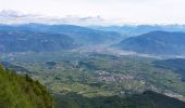
Randonnée A pied de 6,7 km à découvrir à Trentin-Haut-Adige, Provincia di Trento, Borgo d'Anaunia. Cette randonnée est proposée par SityTrail - itinéraires balisés pédestres.
Description
Randonnée créée par Società degli Alpinisti Tridentini.
Site web: http://www.sat.tn.it/
Localisation
Pays :
Italie
Région :
Trentin-Haut-Adige
Département/Province :
Provincia di Trento
Commune :
Borgo d'Anaunia
Localité :
Unknown
Départ:(Dec)
Départ:(UTM)
664977 ; 5144761 (32T) N.
Commentaires
Randonnées à proximité
![Randonnée A pied Borgo d'Anaunia - IT-O542 - Photo](https://media.geolcdn.com/t/375/260/be52b690-f522-4dd7-8820-f2405c2d8bfe.jpeg&format=jpg&maxdim=2)
![A pied A pied](https://static1.geolcdn.com/sitytour/trail-icons/100.png)
IT-O542
A pied
Facile
Borgo d'Anaunia,
Trentin-Haut-Adige,
Provincia di Trento,
Italie
![](/images/other/stat-length.png)
4,9 km | 6,4 km-effort
1h 27min
![](https://static1.geolcdn.com/siteimages/upload/files/16400158638029165_repeat_loop_refresh_sync_direction_icon.png)
Non
![Randonnée A pied Borgo d'Anaunia - (SI C07) Fondo - Malosco - Regole di Malosco - Passo Mendola - Rifugio Mezzavia - Malga Romeno (bivio Rifugio Oltradige) - Photo](https://media.geolcdn.com/t/375/260/04214ba3-e520-40b4-b9f4-43cee1a40e0a.jpeg&format=jpg&maxdim=2)
![A pied A pied](https://static1.geolcdn.com/sitytour/trail-icons/100.png)
(SI C07) Fondo - Malosco - Regole di Malosco - Passo Mendola - Rifugio Mezzav...
A pied
Moyen
Borgo d'Anaunia,
Trentin-Haut-Adige,
Provincia di Trento,
Italie
![](/images/other/stat-length.png)
16,5 km | 28 km-effort
6h 15min
![](https://static1.geolcdn.com/siteimages/upload/files/16400158638029165_repeat_loop_refresh_sync_direction_icon.png)
Non
![Randonnée A pied Borgo d'Anaunia - Sentiero attrezzato del Mondino - Photo](https://media.geolcdn.com/t/375/260/43e5f221-60c6-4895-b115-e41fe77f720e.jpeg&format=jpg&maxdim=2)
![A pied A pied](https://static1.geolcdn.com/sitytour/trail-icons/100.png)
Sentiero attrezzato del Mondino
A pied
Facile
Borgo d'Anaunia,
Trentin-Haut-Adige,
Provincia di Trento,
Italie
![](/images/other/stat-length.png)
6,8 km | 15,7 km-effort
3h 33min
![](https://static1.geolcdn.com/siteimages/upload/files/16400158638029165_repeat_loop_refresh_sync_direction_icon.png)
Non
![Randonnée A pied Cavareno - IT-O527 - Photo](https://media.geolcdn.com/t/375/260/ac16ccab-8789-4045-ad3a-9085f3553305.jpeg&format=jpg&maxdim=2)
![A pied A pied](https://static1.geolcdn.com/sitytour/trail-icons/100.png)
IT-O527
A pied
Facile
Cavareno,
Trentin-Haut-Adige,
Provincia di Trento,
Italie
![](/images/other/stat-length.png)
5,8 km | 9,6 km-effort
2h 11min
![](https://static1.geolcdn.com/siteimages/upload/files/16400158638029165_repeat_loop_refresh_sync_direction_icon.png)
Non
![Randonnée A pied Borgo d'Anaunia - IT-O513 - Photo](https://media.geolcdn.com/t/375/260/46f25469-9a33-41d1-830c-0eadcf79be48.jpeg&format=jpg&maxdim=2)
![A pied A pied](https://static1.geolcdn.com/sitytour/trail-icons/100.png)
IT-O513
A pied
Facile
Borgo d'Anaunia,
Trentin-Haut-Adige,
Provincia di Trento,
Italie
![](/images/other/stat-length.png)
8,8 km | 17,1 km-effort
3h 53min
![](https://static1.geolcdn.com/siteimages/upload/files/16400158638029165_repeat_loop_refresh_sync_direction_icon.png)
Non
![Randonnée A pied Borgo d'Anaunia - Via delle Regole - Photo](https://media.geolcdn.com/t/375/260/02499335-2199-4d15-a8ef-16d009b6df4e.jpeg&format=jpg&maxdim=2)
![A pied A pied](https://static1.geolcdn.com/sitytour/trail-icons/100.png)
Via delle Regole
A pied
Facile
Borgo d'Anaunia,
Trentin-Haut-Adige,
Provincia di Trento,
Italie
![](/images/other/stat-length.png)
7,1 km | 13,5 km-effort
3h 4min
![](https://static1.geolcdn.com/siteimages/upload/files/16400158638029165_repeat_loop_refresh_sync_direction_icon.png)
Non
![Randonnée A pied Borgo d'Anaunia - IT-O512 - Photo](https://media.geolcdn.com/t/375/260/4c7f7987-e842-4d80-9dfb-eaa1b44ab7a7.jpeg&format=jpg&maxdim=2)
![A pied A pied](https://static1.geolcdn.com/sitytour/trail-icons/100.png)
IT-O512
A pied
Facile
Borgo d'Anaunia,
Trentin-Haut-Adige,
Provincia di Trento,
Italie
![](/images/other/stat-length.png)
4 km | 8,8 km-effort
2h 0min
![](https://static1.geolcdn.com/siteimages/upload/files/16400158638029165_repeat_loop_refresh_sync_direction_icon.png)
Non
![Randonnée A pied Borgo d'Anaunia - IT-O511 - Photo](https://media.geolcdn.com/t/375/260/1dffa800-6956-417d-b373-381c0c7364e1.jpeg&format=jpg&maxdim=2)
![A pied A pied](https://static1.geolcdn.com/sitytour/trail-icons/100.png)
IT-O511
A pied
Facile
Borgo d'Anaunia,
Trentin-Haut-Adige,
Provincia di Trento,
Italie
![](/images/other/stat-length.png)
6,1 km | 11,8 km-effort
2h 40min
![](https://static1.geolcdn.com/siteimages/upload/files/16400158638029165_repeat_loop_refresh_sync_direction_icon.png)
Non
![Randonnée A pied Ronzone - IT-O515 - Photo](https://media.geolcdn.com/t/375/260/2ca53f6c-a8d1-4bb4-8b8d-dd323f5c0e13.jpeg&format=jpg&maxdim=2)
![A pied A pied](https://static1.geolcdn.com/sitytour/trail-icons/100.png)
IT-O515
A pied
Facile
Ronzone,
Trentin-Haut-Adige,
Provincia di Trento,
Italie
![](/images/other/stat-length.png)
7,1 km | 11 km-effort
2h 30min
![](https://static1.geolcdn.com/siteimages/upload/files/16400158638029165_repeat_loop_refresh_sync_direction_icon.png)
Non